GEO Development, Ltd. - certified surveyors, topographical plans
Photo 12


Working time
- Sun-
- Mon830-1730
- Tue830-1730
- Wed830-1730
- Thu830-1730
- Fri830-1730
- Sat-
Legal data
- 40003956979
- LV40003956979
- 21.09.2007
- Lapeņu iela 7, Rīga, LV-1013
- 2025
LTD "GEO DEVELOPMENT" - a reliable partner in surveying and geodesy since 2007. annual
LTD "GEO Development" since 2007. has been providing professional surveying, geodesy, design and geospatial data acquisition services throughout Latvia since. We work with private individuals, construction companies, designers, real estate developers and municipalities.
Our team consists of certified surveyors with many years of experience. We help prepare the necessary surveying documentation for design, construction, property development and commissioning of buildings.
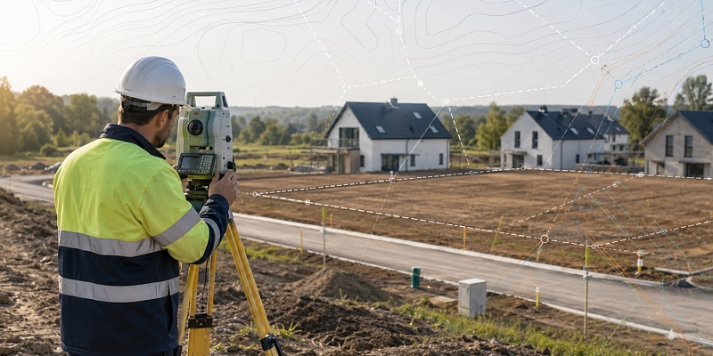
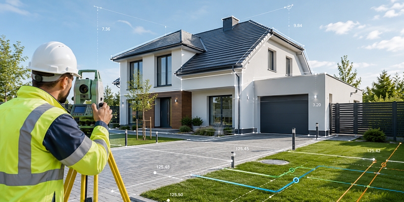
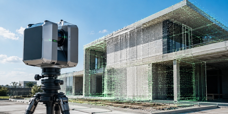
We provide topographic surveying, topographic plans, executive measurements, utility surveying, cadastral surveying, building marking, 3D surveying, laser scanning, aerial photography and GIS solutions.
LTD "GEO Development" offers both standard surveying services and individual solutions for more complex projects. We work with modern technologies and precise surveying methods, ensuring high-quality, reliable results that comply with regulatory requirements.
LTD "GEO Development" is a member of the Latvian Association of Cartographers and Geodesists.
Services
- For private persons:
Topographic plan for construction project;
Executive measurement for commissioning of a building;
Land division;
Border issues and border restoration;
Consultation on necessary surveying documentation/services. - For companies / designers / builders:
Surveying works in construction;
Laser scanning;
Photogrammetry;
3D surveying of bridges and engineering structures;
Bathymetry;
3D terrain models of the area.
Proposal preparation
To prepare an offer, send the property address or cadastral number and a brief description of the situation and we will contact you with a specific offer.
Keywords
Laser scanning, 3D scanning, Topographical plan.
More
surveying, surveyor, certified surveyor, land surveyor, surveying services, surveying works, construction surveyor, executive measurements for construction, surveyor for a house project, land surveyor, surveying services throughout Latvia, geodesy, geodesist, geodesic works, engineering geodetic works, construction geodesy, topography, topographical survey, topographical plan, topographic plan for construction, topographic plan for design, topographic plan for a house project, topographic plan of the land plot, ADTI data, ADTI coordination, execution measurements, performance measurement plan, executive measurement after construction, executive measure for commissioning a house, construction Execution Measurement, building performance measurement, engineering communications executive measurement, documents for commissioning the house, land surveying, land surveying, cadastral survey, border surveying, border recovery, border plan, land use, land use planning project, building demarcation, construction axis marking, track marking, laying of communications, geodetic control, building monitoring, 3D surveying, 3D laser scanning, laser scanning, LiDAR, LiDAR data acquisition, BIM surveying, BIM model, as-built model, point cloud, building surveying, surveying of buildings, facade surveying, aerial photography, aerial photo, drone surveying, drone mapping, photogrammetry, orthophoto, territory mapping with a drone, volume calculations, relief pattern, digital terrain model, bathymetry, bathymetric survey, surveying of water bodies, hydrographic measurements, geospatial data, geospatial data mining, geospatial data processing, geospatial information, cartography, GIS solutions, CAD surveys, DWG plans, AutoCAD surveys, surveying for designers, surveying for builders, surveying for developers, surveying for municipalities, surveying for infrastructure projects, surveying for road construction, surveying for civil engineering structures, geodesy in Latvia, topography in Latvia, surveying works Riga, certified surveyor Riga, topography Riga, land cadastral survey Riga, development of land use projects Riga
Website